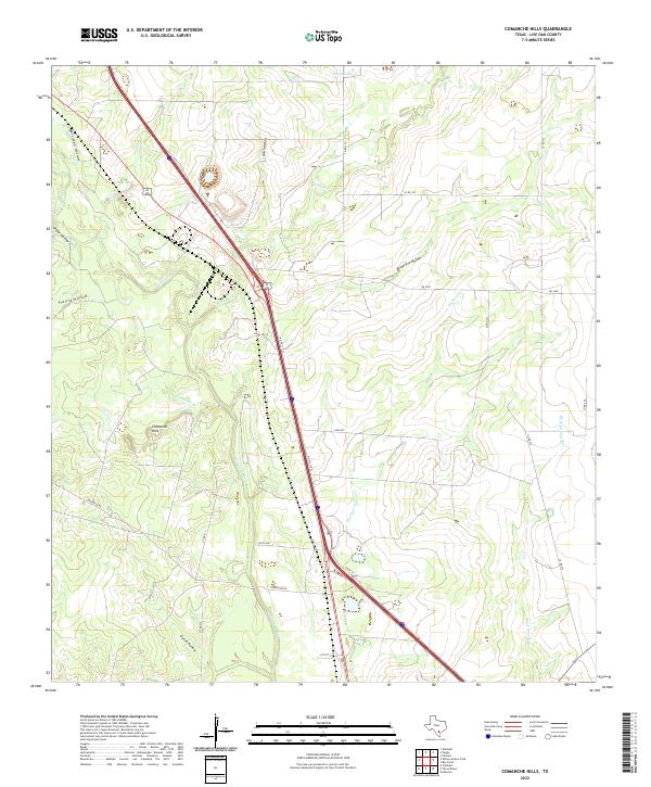
2022 Map of Comanche Hills
USGS Topo · Published 2022About this map
The Atascosa River winds through this South Texas landscape, carving a path between the Comanche Hills and several distinct drainage basins. The area is defined by a dense network of named topographical depressions, including Merriman Hollow, Ursher Hollow, and Brush Pen Hollow, which speak to the historic ranching and geography of Live Oak County. This modern survey illustrates how infrastructure has adapted to the terrain, with Alt 281 and the N Hwy 37 Acc cutting a straight diagonal across the natural meandering of waterways like Weedy Cr and Comanche Br. Remote water features like House Lake and the branching paths of Rock Quarry Br provide specific points of interest for those studying the localized hydrology and land use patterns of the Brush Country.
Find a feature on this map
26 named features on this map. Tap any name to fly to it.
Don’t see what you’re looking for? This feature index may not catch every label — zoom into the map to look around manually.
Map Details
Editions of this 2022 Comanche Hills Map
This is the sole edition of this map. No revisions or reprints were ever made.
Other maps of this area

1920 · Mikeska
USGS Topo · 1:125,000

1925 · Simmons No. 1
USGS Topo · 1:48,000

1927 · Oakville
USGS Topo · 1:62,500

1929 · Simmons
USGS Topo · 1:62,500

1930 · Whitsett
USGS Topo · 1:62,500

1942 · Whitsett
USGS Topo · 1:62,500

1953 · Crystal City
USGS Topo · 1:250,000

1955 · Crystal City
USGS Topo · 1:250,000

1956 · Suniland
USGS Topo · 1:62,500

1961 · Crystal City
USGS Topo · 1:250,000