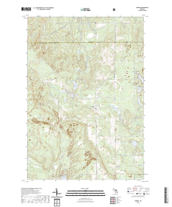
2023 Map of Comins
USGS Topo · Published 2023About this map
The settlement of Comins sits at the intersection of Co Hwy 616 and N Abbe Rd, serving as a central point in this northern Michigan landscape. North of the Montmorency Co Oscoda Co boundary, the terrain is defined by a dense network of small water bodies and marshlands. Significant landmarks include Loud Cem near the northern edge and the extensive Huron National Forest to the south. The area is interlaced with recreational paths like the Hunt Creek Motorcycle Trl and the Mio Trl, reflecting the region's importance for outdoor activities. Hydrological features are prominent, with Gilchrist Creek and Greasy Creek feeding into numerous basins such as Whitabee Lake and Comins Marsh. This survey also documents local family names and landmarks through road labels like Eberly Rd and Lowry Ln, alongside natural features like Boiling Springs.
Find a feature on this map
66 named features on this map. Tap any name to fly to it.
Don’t see what you’re looking for? This feature index may not catch every label — zoom into the map to look around manually.
Map Details
Editions of this 2023 Comins Map
This is the sole edition of this map. No revisions or reprints were ever made.
Other maps of this area

1954 · Traverse City
USGS Topo · 1:250,000

1954 · Tawas City
USGS Topo · 1:250,000

1955 · Comins
USGS Topo · 1:62,500

1958 · Traverse City
USGS Topo · 1:250,000

1958 · Tawas City
USGS Topo · 1:250,000

1972 · McKinley
USGS Topo · 1:24,000

1972 · McCollum Lake
USGS Topo · 1:24,000

1972 · Mio
USGS Topo · 1:24,000
1972 · Rust
USGS Topo · 1:24,000
1972 · Fairview
USGS Topo · 1:24,000