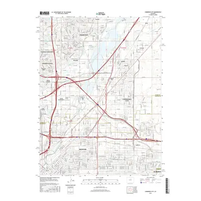
2016 Map of Commerce City
USGS Topo · Published 2016About this map
The South Platte River and its accompanying South Platte River Greenway anchor this urban and industrial landscape north of downtown Denver. The map documents a complex hydraulic and transport network where the BNSF Railway and major interstates intersect historical water infrastructure like the Burlington Ditch, Fisher Ditch, and Colorado-Agricultural Canal. This interplay of natural waterways and engineered canals defines the development patterns of Commerce City, Thornton, and Federal Heights.
Find a feature on this map
130 named features on this map. Tap any name to fly to it.
Don’t see what you’re looking for? This feature index may not catch every label — zoom into the map to look around manually.
Map Details
Editions of this 2016 Commerce City Map
This is the sole edition of this map. No revisions or reprints were ever made.
Other maps of this area

1890 · East Denver
USGS Topo · 1:125,000

1899 · West Denver
USGS Topo · 1:125,000

1935 · East Denver Nos. 3 and 4
USGS Topo · 1:48,000

1938 · Derby
USGS Topo · 1:24,000

1938 · Long Branch
USGS Topo · 1:24,000

1940 · Brighton
USGS Topo · 1:31,680

1940 · Englewood
USGS Topo · 1:31,680

1940 · Eastlake
USGS Topo · 1:31,680

1940 · Lafayette
USGS Topo · 1:31,680

1940 · Derby
USGS Topo · 1:31,680