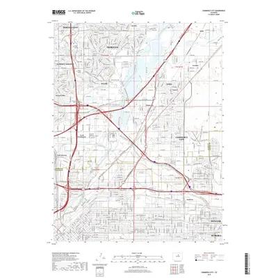
2019 Map of Commerce City
USGS Topo · Published 2019About this map
Commerce City and the industrial corridors of the South Platte River define this 2019 survey, illustrating the complex intersection of freight rail and urban expansion. The BNSF Railway and extensive water infrastructure like the Burlington Ditch and O'Brian Canal trace the historic movement of resources through the northern Denver metro area. Smaller, established neighborhoods such as Welby, Derby, and Irondale are shown alongside significant municipal features including the expansive Riverside Cem and Rose Hill Cem. The map provides a contemporary view of the regional trail network, featuring the Sand Creek Greenway Trail and South Platte River Trail, which now weave through areas formerly dominated by heavy industry and rail junctions at Utah Junction.
Find a feature on this map
48 named features on this map. Tap any name to fly to it.
Don’t see what you’re looking for? This feature index may not catch every label — zoom into the map to look around manually.
Map Details
Editions of this 2019 Commerce City Map
This is the sole edition of this map. No revisions or reprints were ever made.
Other maps of this area

1890 · East Denver
USGS Topo · 1:125,000

1899 · West Denver
USGS Topo · 1:125,000

1935 · East Denver Nos. 3 and 4
USGS Topo · 1:48,000

1938 · Derby
USGS Topo · 1:24,000

1938 · Long Branch
USGS Topo · 1:24,000

1940 · Brighton
USGS Topo · 1:31,680

1940 · Englewood
USGS Topo · 1:31,680

1940 · Eastlake
USGS Topo · 1:31,680

1940 · Lafayette
USGS Topo · 1:31,680

1940 · Derby
USGS Topo · 1:31,680