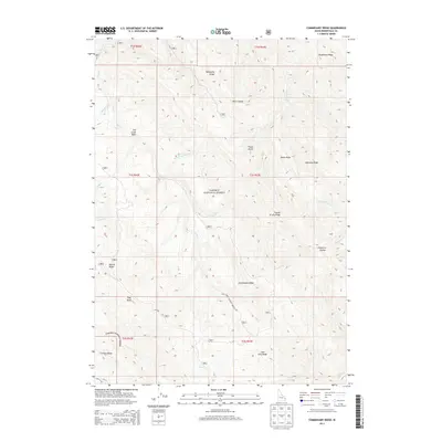
2013 Map of Commissary Ridge
USGS Topo · Published 2013About this map
Caribou National Forest dominates this section of Bonneville County, where the high country of the Caribou Range is defined by a series of prominent, roughly parallel ridges and deep drainage basins. The eponymous Commissary Ridge runs centrally through the map, part of an intricate network of high-elevation landmarks including Fourth of July Ridge, Deadhorse Ridge, and Mahogany Ridge. Hydrological patterns are dictated by the numerous forks of Fall Cr, which drain the Fall Creek Basin and Rash Canyon. These waters are joined by smaller tributaries like Willow Springs Cr and Chaparral Cr, showing the complex watershed that feeds the region. Human passage through this high-altitude landscape is limited to specialized routes such as Skyline Rd and the Natl Forest Develop Road 017 Rd, which provide access to the timber and grazing lands within the national forest boundary.
Find a feature on this map
35 named features on this map. Tap any name to fly to it.
Don’t see what you’re looking for? This feature index may not catch every label — zoom into the map to look around manually.
Map Details
Editions of this 2013 Commissary Ridge Map
This is the sole edition of this map. No revisions or reprints were ever made.
Other maps of this area

1917 · Cranes Flat
USGS Topo · 1:62,500

1924 · Hell Creek
USGS Topo · 1:62,500

1926 · Hell Creek
USGS Topo · 1:62,500

1932 · Irwin
USGS Topo · 1:96,000

1935 · Irwin
USGS Topo · 1:125,000

1955 · Driggs
USGS Topo · 1:250,000

1958 · Driggs
USGS Topo · 1:250,000

1962 · Driggs
USGS Topo · 1:250,000

1966 · Big Elk Mtn
USGS Topo · 1:24,000

1966 · Conant Valley
USGS Topo · 1:24,000