
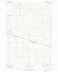
1972 Map of Community Lake
USGS Topo · Published 1976About this map
The Lincoln and Minidoka County line bisects this 1970s landscape, revealing a high desert environment heavily modified for water storage and livestock. The area is defined by its series of man-made and seasonal water features, notably the Section 28 Reservoir and the Kimama Marsh Reservoir, which stand alongside naturally occurring basins like Community Lake. This infrastructure reflects the region's agricultural adaptation, where the management of scarce water resources was central to sustaining life on the Idaho plains. Isolated landmarks such as the Peavey Well and a solitary Water Tank indicate the vital role of groundwater extraction in this arid terrain. Scattered across the quadrangle, several smaller pools including Section 25 Lake, Halfway Lake, and Little Lake highlight the topography's natural depressions and their importance to local land use during the early 1970s.
Find a feature on this map
13 named features on this map. Tap any name to fly to it.
Don’t see what you’re looking for? This feature index may not catch every label — zoom into the map to look around manually.
Map Details
Editions of this 1972 Community Lake Map
This is the sole edition of this map. No revisions or reprints were ever made.
Other maps of this area

1954 · Pocatello
USGS Topo · 1:250,000

1955 · Idaho Falls
USGS Topo · 1:250,000

1958 · Idaho Falls
USGS Topo · 1:250,000

1958 · Pocatello
USGS Topo · 1:250,000

1972 · Shale Butte
USGS Topo · 1:24,000

1972 · Kimama
USGS Topo · 1:24,000

1972 · Max
USGS Topo · 1:24,000

1972 · Laidlaw Lake
USGS Topo · 1:24,000

1972 · Bottleneck Lake
USGS Topo · 1:24,000
1972 · Norland
USGS Topo · 1:24,000