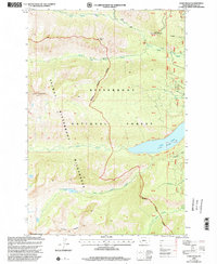
1999 Map of Como Peaks
USGS Topo · Published 2002About this map
Como Lake and its surrounding drainage basin define this high-elevation landscape within the Bitterroot National Forest. The map documents a complex network of hydrologic features and high-altitude terrain, from the Spillway Elevation 4245 to the soaring Como Peaks and Koch Mountain. The transition between managed forest land and the Selway-Bitterroot Wilderness is marked by an indefinite boundary, reflecting the late 20th-century management of these protected lands.
Find a feature on this map
25 named features on this map. Tap any name to fly to it.
Don’t see what you’re looking for? This feature index may not catch every label — zoom into the map to look around manually.
Map Details
Editions of this 1999 Como Peaks Map
This is the sole edition of this map. No revisions or reprints were ever made.
Other maps of this area

1901 · Hamilton
USGS Topo · 1:125,000

1956 · Elk City
USGS Topo · 1:250,000

1956 · Hamilton
USGS Topo · 1:250,000

1959 · Hamilton
USGS Topo · 1:250,000

1960 · Elk City
USGS Topo · 1:250,000

1960 · Hamilton
USGS Topo · 1:250,000

1964 · Hamilton
USGS Topo · 1:250,000

1964 · Hamilton South
USGS Topo · 1:24,000

1964 · Burnt Ridge
USGS Topo · 1:24,000

1964 · Tenmile Lake
USGS Topo · 1:24,000