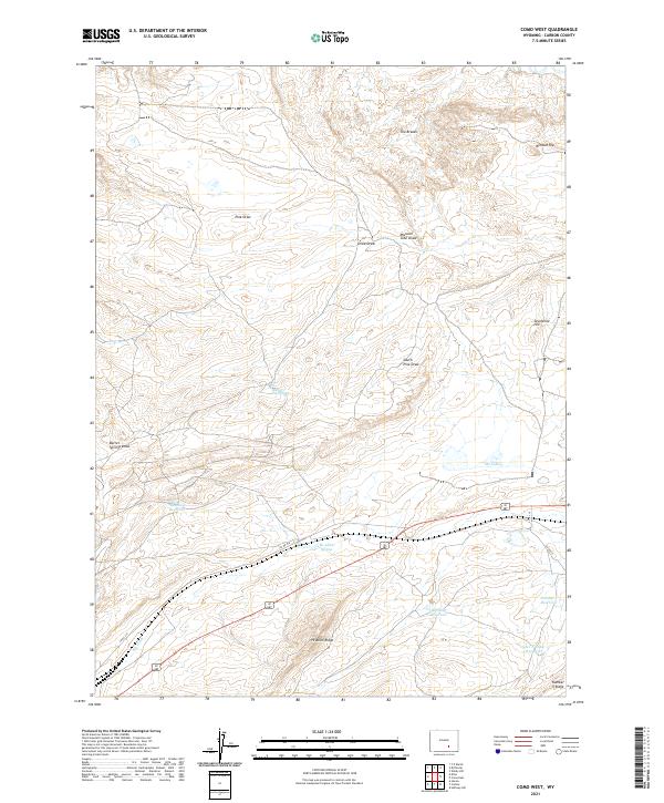
2021 Map of Como West
USGS Topo · Published 2021About this map
High desert drainage patterns and early ranching-era infrastructure define this landscape in Carbon County. Water management is central to the area's utility, evidenced by the presence of Big Ditch and several named catchments like Big Rock Reservoir and Rosebud Reservoir. These features suggest a history of managing the arid climate for livestock or agricultural use. The terrain is marked by a series of significant draws, including Missouri John Draw and South Pine Draw, which channel seasonal runoff toward the lower plains.
Find a feature on this map
26 named features on this map. Tap any name to fly to it.
Don’t see what you’re looking for? This feature index may not catch every label — zoom into the map to look around manually.
Map Details
Editions of this 2021 Como West Map
This is the sole edition of this map. No revisions or reprints were ever made.
Other maps of this area

1893 · Fort Steele
USGS Topo · 1:125,000

1914 · Hanna
USGS Topo · 1:62,500

1914 · Saddleback Hills
USGS Topo · 1:62,500

1921 · Saddleback Hills
USGS Topo · 1:62,500

1953 · T E Ranch
USGS Topo · 1:24,000

1954 · Rawlins
USGS Topo · 1:250,000

1955 · Casper
USGS Topo · 1:250,000

1958 · Rawlins
USGS Topo · 1:250,000

1958 · Casper
USGS Topo · 1:250,000
1961 · Windy Hill
USGS Topo · 1:24,000