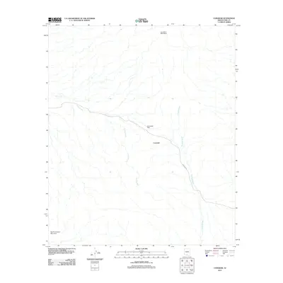
2011 Map of Comobabi
USGS Topo · Published 2011About this map
Comobabi sits at the heart of this high-desert landscape in Pima County, positioned near the strategic Comobabi Pass. The settlement’s location is defined by the drainage patterns of the Ko Vaya Wash and Comobabi Wash, which cut through the arid basin. To the north, the Comobari Mountains dominate the horizon, while the South Comobabi Mountains anchor the southern portion of the quadrangle. Transportation through this part of the Schuk Toak District is facilitated by Indian Rte 30, which follows the natural contours of the terrain. The map illustrates a traditional desert settlement pattern where roads and small outposts are dictated by the mountain passes and seasonal watercourses common to the Arizona interior.
Find a feature on this map
7 named features on this map. Tap any name to fly to it.
Don’t see what you’re looking for? This feature index may not catch every label — zoom into the map to look around manually.
Map Details
Editions of this 2011 Comobabi Map
This is the sole edition of this map. No revisions or reprints were ever made.
Other maps of this area

1934 · Silver Bell
USGS Topo · 1:125,000

1937 · Comobabi
USGS Topo · 1:48,000

1938 · San Vicente
USGS Topo · 1:62,500

1941 · San Vicente
USGS Topo · 1:62,500

1941 · Baboquivari Peak
USGS Topo · 1:62,500

1941 · Sells
USGS Topo · 1:62,500

1942 · San Vicente
USGS Topo · 1:62,500

1942 · Comobabi
USGS Topo · 1:62,500

1943 · Sells
USGS Topo · 1:62,500

1943 · Fresnal
USGS Topo · 1:125,000