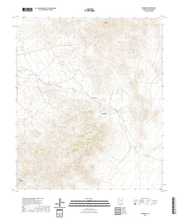
2021 Map of Comobabi
USGS Topo · Published 2021About this map
Comobabi sits at the center of this high-desert landscape in Pima County, positioned at the transition between the Comobabi Mountains to the north and the South Comobabi Mountains below. The terrain is defined by complex drainage networks, where Ko Vaya Wash and Comobabi Wash carry seasonal runoff through the alluvial plains. This 2021 survey illustrates a region shaped by traditional travel routes, including the passage through Comobabi Pass and the course of Indian Rte 30. The map provides a contemporary view of the Public Land Survey System divisions, such as t15s r5e, reflecting how this portion of the Tohono O'odham Nation is organized and managed in the modern era.
Find a feature on this map
12 named features on this map. Tap any name to fly to it.
Don’t see what you’re looking for? This feature index may not catch every label — zoom into the map to look around manually.
Map Details
Editions of this 2021 Comobabi Map
This is the sole edition of this map. No revisions or reprints were ever made.
Other maps of this area

1934 · Silver Bell
USGS Topo · 1:125,000

1937 · Comobabi
USGS Topo · 1:48,000

1938 · San Vicente
USGS Topo · 1:62,500

1941 · San Vicente
USGS Topo · 1:62,500

1941 · Baboquivari Peak
USGS Topo · 1:62,500

1941 · Sells
USGS Topo · 1:62,500

1942 · San Vicente
USGS Topo · 1:62,500

1942 · Comobabi
USGS Topo · 1:62,500

1943 · Sells
USGS Topo · 1:62,500

1943 · Fresnal
USGS Topo · 1:125,000