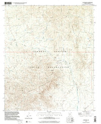
1996 Map of Comobabi
USGS Topo · Published 2002About this map
The Tohono O'odham Indian Reservation dominates this desert landscape, where the granite peaks of the North Comobabi Mountains and South Comobabi Mountains rise above the surrounding terrain. Small O'odham communities like Ko Vaya, Comobabi, and Suwuki Vaya are established at the base of these ranges, connected by a network of unimproved roads and washes. The geography is defined by the steep transition through Comobabi Pass and the broad drainage of the Comobabi Wash as it moves toward the Baboquivari Valley.
Find a feature on this map
15 named features on this map. Tap any name to fly to it.
Don’t see what you’re looking for? This feature index may not catch every label — zoom into the map to look around manually.
Map Details
Editions of this 1996 Comobabi Map
This is the sole edition of this map. No revisions or reprints were ever made.
Other maps of this area

1934 · Silver Bell
USGS Topo · 1:125,000

1937 · Comobabi
USGS Topo · 1:48,000

1938 · San Vicente
USGS Topo · 1:62,500

1941 · San Vicente
USGS Topo · 1:62,500

1941 · Baboquivari Peak
USGS Topo · 1:62,500

1941 · Sells
USGS Topo · 1:62,500

1942 · San Vicente
USGS Topo · 1:62,500

1942 · Comobabi
USGS Topo · 1:62,500

1943 · Sells
USGS Topo · 1:62,500

1943 · Fresnal
USGS Topo · 1:125,000