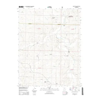
2015 Map of Competition
USGS Topo · Published 2015About this map
The Gasconade River carves a winding path through the northern reaches of Wright County and southern Laclede County, defining a landscape of sharp ridges and deep valleys. This 2015 survey captures a network of small, rural settlements including Competition, Jerktail, and Saint George, which are connected by a web of local roads and lanes. The map provides significant detail for genealogists, documenting family-linked landmarks such as the Emerson Cemetery and Dorris Cemetery, as well as historical transit points like Burney Ford on the river. Portions of the Mark Twain National Forest occupy the northeastern corner, where the terrain falls away into Wichita Hollow and toward the banks of Beaver Creek. The drainage patterns of Sutton Br and Elk Cr further illustrate the dissected geography of this Ozark region.
Find a feature on this map
49 named features on this map. Tap any name to fly to it.
Don’t see what you’re looking for? This feature index may not catch every label — zoom into the map to look around manually.
Map Details
Editions of this 2015 Competition Map
This is the sole edition of this map. No revisions or reprints were ever made.
Other maps of this area

1931 · Manes
USGS Topo · 1:48,000

1941 · Manes
USGS Topo · 1:62,500

1941 · Lebanon
USGS Topo · 1:62,500

1943 · Lebanon
USGS Topo · 1:62,500

1943 · Manes
USGS Topo · 1:62,500

1943 · Drynob
USGS Topo · 1:62,500

1954 · Springfield
USGS Topo · 1:250,000

1954 · Drynob
USGS Topo · 1:62,500

1954 · Drew
USGS Topo · 1:24,000
1954 · Winnipeg
USGS Topo · 1:24,000