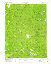
1960 Map of Comptche
USGS Topo · Published 1962About this map
Comptche serves as a central point in this mid-century portrait of Mendocino County's timber-rich interior, where the California Western Railroad winds through the canyons of the South Fork Noyo River. The landscape is defined by its industrial and conservation history, showing the extensive Jackson State Forest and various camps such as the Parlin Fork Conservation Camp and Chamberlain Creek Conservation Camp. Settlement patterns are closely tied to the topography and rail lines, with small outposts like Irmulco, Glenblair, and Northspur following the river valleys and ridges. Natural features such as Whiskey Springs and the coastal proximity of Van Damme Beach State Park are clearly visible, while high points like Mathison Pk Lookout and McGuire Hill provide the essential vantage points for this densely forested terrain.
Find a feature on this map
93 named features on this map. Tap any name to fly to it.
Don’t see what you’re looking for? This feature index may not catch every label — zoom into the map to look around manually.
Map Details
Editions of this 1960 Comptche Map
2 editions found
Other maps of this area

1920 · Glenblair
USGS Topo · 1:62,500

1920 · Fort Bragg
USGS Topo · 1:62,500

1921 · Westport
USGS Topo · 1:62,500

1921 · Branscomb
USGS Topo · 1:62,500

1922 · Willits
USGS Topo · 1:62,500

1942 · Willits
USGS Topo · 1:62,500

1943 · Glenblair
USGS Topo · 1:62,500

1943 · Fort Bragg
USGS Topo · 1:62,500

1943 · Albion
USGS Topo · 1:62,500

1943 · Boonville
USGS Topo · 1:62,500