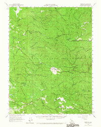
1960 Map of Comptche
USGS Topo · Published 1967About this map
The California Western Railroad winds through the heart of the Mendocino coast range on this survey, following the drainage of the South Fork Noyo River toward the interior. The landscape is defined by the timber and conservation history of the mid-twentieth century, dominated by the Jackson State Forest and its various camps such as the Parlin Fork Conservation Camp and Chamberlain Creek Conservation Camp. Small coastal settlements and sidings like Glenblair, Irmulco, and Hayshed Siding mark the path of the rails, while the namesake village of Comptche sits further south in a clearing along the Albion River. Elevated sites like Mathison Pk Lookout and Observatory Hill provide vantage points over a complex topography of ridges including Three Chop Ridge and H-Chute Ridge. This 1960s perspective captures a working forest transition, where old logging camps like Old Camp Seven exist alongside state parks such as Russian Gulch State Park and Van Damme Beach State Park.
Find a feature on this map
104 named features on this map. Tap any name to fly to it.
Don’t see what you’re looking for? This feature index may not catch every label — zoom into the map to look around manually.
Map Details
Editions of this 1960 Comptche Map
2 editions found
Other maps of this area

1920 · Glenblair
USGS Topo · 1:62,500

1920 · Fort Bragg
USGS Topo · 1:62,500

1921 · Westport
USGS Topo · 1:62,500

1921 · Branscomb
USGS Topo · 1:62,500

1922 · Willits
USGS Topo · 1:62,500

1942 · Willits
USGS Topo · 1:62,500

1943 · Glenblair
USGS Topo · 1:62,500

1943 · Fort Bragg
USGS Topo · 1:62,500

1943 · Albion
USGS Topo · 1:62,500

1943 · Boonville
USGS Topo · 1:62,500