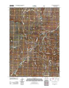
2011 Map of Conant Basin
USGS Topo · Published 2011About this map
Major County, Oklahoma, in 1974 shows a landscape shaped by agriculture and religious heritage, particularly around the city of Fairview. The area is defined by its rural community structures, including numerous schools and churches. Notable religious sites include the Mennonite Brethren Ch and Mennonite Ch in Fairview, along with the Concord Ch and Saron Ch located in the surrounding countryside. Education was centered at sites like Progressive Sch, Center View Sch, and Plymouth Sch. Transportation and commerce were facilitated by the Atchison Topeka and Santa Fe and Chicago Rock Island and Pacific railroads. Natural features such as the Cimarron River and the Glass Mountains within Gloss Mountain State Park provided a distinct geographical backdrop to settlements like Cleo Springs, Orion, and Cheyenne Valley. The Fairview Cemetery stands as a significant site for genealogical research.
Find a feature on this map
33 named features on this map. Tap any name to fly to it.
Don’t see what you’re looking for? This feature index may not catch every label — zoom into the map to look around manually.
Map Details
Editions of this 2011 Conant Basin Map
This is the sole edition of this map. No revisions or reprints were ever made.
Other maps of this area

1946 · Eagle Rock
USGS Topo · 1:62,500

1948 · Eagle Rock
USGS Topo · 1:62,500

1951 · Post
USGS Topo · 1:62,500

1955 · Crescent
USGS Topo · 1:250,000

1955 · Bend
USGS Topo · 1:250,000

1957 · Crescent
USGS Topo · 1:250,000

1957 · Bend
USGS Topo · 1:250,000

1958 · Crescent
USGS Topo · 1:250,000

1958 · Bend
USGS Topo · 1:250,000

1967 · Brothers NW
USGS Topo · 1:24,000