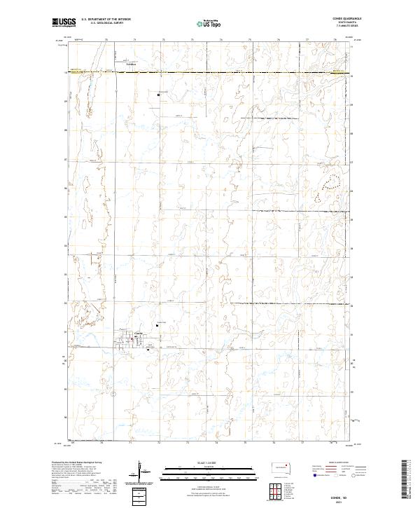
2021 Map of Conde
USGS Topo · Published 2021About this map
Conde and Verdon anchor this agricultural landscape on the border of Brown and Spink Counties. The town of Conde is laid out in a traditional grid featuring streets such as Cedar St, Maple St, and Main St, centered near the intersection of State Hwy 20. The surrounding prairie is defined by section lines and drainage patterns like Dry Run, which cuts through the northwestern corner near the small community of Verdon. Local history is preserved in the placement of several rural burial sites, including Conde Cem, Verdon Cem, and Saint John's Cem, reflecting the early settlement and social centers of these township sections during the early 21st century.
Find a feature on this map
26 named features on this map. Tap any name to fly to it.
Don’t see what you’re looking for? This feature index may not catch every label — zoom into the map to look around manually.
Map Details
Editions of this 2021 Conde Map
This is the sole edition of this map. No revisions or reprints were ever made.
Other maps of this area

1894 · Conde
USGS Topo · 1:62,500

1895 · Aberdeen
USGS Topo · 1:125,000

1953 · Groton SW
USGS Topo · 1:24,000

1953 · Milbank
USGS Topo · 1:250,000

1954 · Ferney
USGS Topo · 1:24,000

1954 · Aberdeen
USGS Topo · 1:250,000

1956 · Aberdeen
USGS Topo · 1:250,000

1958 · Milbank
USGS Topo · 1:250,000
1958 · Randolph
USGS Topo · 1:24,000
1958 · Conde
USGS Topo · 1:24,000