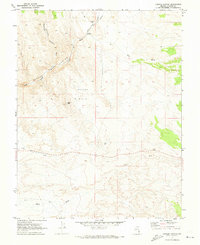
1970 Map of Condor Canyon
USGS Topo · Published 1973About this map
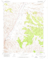
Meadow Valley Wash carves through the arid landscape of Lincoln County, providing a critical north-south corridor for the Union Pacific railroad during the early 1970s. This survey, grounded in 1969 aerial photography, reveals the sparse but vital human footprints in the high desert, most notably at Delmue Ranch where water from nearby Springs supports localized activity. The drainage patterns of Hamlight Canyon and Dry Wash illustrate the complex watershed that feeds into the main valley, while the Panaca Hills dominate the central terrain. Significant landmarks for local navigation and history include the Landmark Letter etched on the slope of Black Hill, a common regional tradition of hillside monograms. Scattered infrastructure such as a Borrow Pit and various Jeep Trails hint at the ongoing utility and exploration of these desert reaches.
Find a feature on this map
17 named features on this map. Tap any name to fly to it.
Don’t see what you’re looking for? This feature index may not catch every label — zoom into the map to look around manually.
Map Details
Editions of this 1970 Condor Canyon Map
This is the sole edition of this map. No revisions or reprints were ever made.
Other maps of this area

1885 · Pioche
USGS Topo · 1:250,000

1886 · Pioche
USGS Topo · 1:250,000

1921 · NW 1/4 Panaca
USGS Topo · 1:48,000

1953 · Pioche
USGS Topo · 1:24,000

1954 · Caliente
USGS Topo · 1:250,000

1959 · Caliente
USGS Topo · 1:250,000
1970 · Panaca
USGS Topo · 1:24,000
1970 · Rose Valley
USGS Topo · 1:24,000
1972 · Panaca Summit
USGS Topo · 1:24,000
1972 · Indian Cove
USGS Topo · 1:24,000