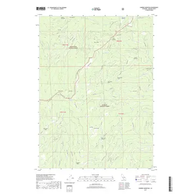
2018 Map of Condrey Mountain
USGS Topo · Published 2018About this map
Klamath National Forest and Rogue River National Forest meet at the high ridges of the Siskiyou Mountains in this modern survey of the California-Oregon border region. The high-altitude landscape is defined by the Pacific Crest National Scenic Trail, which winds past Condrey Mtn and over the Siskiyou Summit. The map documents a terrain punctuated by glades and meadows, such as Quaken Asp Glade, Donomore Meadows, and Deer Camp Meadows, which likely served as seasonal landmarks for grazing and early forest management.
Find a feature on this map
69 named features on this map. Tap any name to fly to it.
Don’t see what you’re looking for? This feature index may not catch every label — zoom into the map to look around manually.
Map Details
Editions of this 2018 Condrey Mountain Map
This is the sole edition of this map. No revisions or reprints were ever made.
Other maps of this area

1886 · Shasta
USGS Topo · 1:250,000

1891 · Ashland
USGS Topo · 1:250,000

1893 · Ashland
USGS Topo · 1:250,000

1894 · Shasta
USGS Topo · 1:250,000

1897 · Ashland
USGS Topo · 1:250,000

1908 · Grants Pass
USGS Topo · 1:125,000

1914 · Seiad
USGS Topo · 1:125,000

1922 · Seiad
USGS Topo · 1:125,000

1932 · Yreka
USGS Topo · 1:96,000

1938 · Medford
USGS Topo · 1:125,000