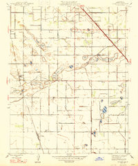
1947 Map of Conejo
USGS Topo · Published 1947About this map
Agricultural development in rural Fresno County centers on a dense network of irrigation canals and family-named landmarks just after the second World War. Small settlements like Monmouth and Conejo serve as hubs for the surrounding farmsteads, which are connected by a rigid grid of avenues named for trees and local figures. The importance of water management in the Central Valley is evident in the numerous private and district ditches, including the Parlier Canal and the Harlan-Stevens Ditch, which feed scattered depressions such as Willow Lake and Ralmke Pond.
Find a feature on this map
56 named features on this map. Tap any name to fly to it.
Don’t see what you’re looking for? This feature index may not catch every label — zoom into the map to look around manually.
Map Details
Editions of this 1947 Conejo Map
This is the sole edition of this map. No revisions or reprints were ever made.
Other maps of this area

1923 · Malaga
USGS Topo · 1:31,680

1923 · Fresno
USGS Topo · 1:31,680

1923 · Sanger
USGS Topo · 1:31,680

1924 · Riverdale
USGS Topo · 1:31,680

1924 · Selma
USGS Topo · 1:31,680

1924 · Conejo
USGS Topo · 1:31,680

1925 · Caruthers
USGS Topo · 1:31,680

1926 · Burris Park
USGS Topo · 1:31,680

1927 · Laton
USGS Topo · 1:31,680

1927 · Riverdale
USGS Topo · 1:31,680