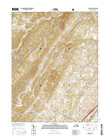
2016 Map of Conicville
USGS Topo · Published 2016About this map
George Washington National Forest borders the northern reaches of this Shenandoah Valley landscape, where the terrain transitions from the high elevations of Threemile Mtn and Supin Lick Ridge down into fertile hollows. The settlement pattern follows the drainage of Stony Cr and Mill Cr, with established communities like Conicville, Mount Clifton, and Basye serving as local anchors. Genealogists will find a high density of burial sites throughout the quadrangle, ranging from Saint Pauls Cem near Jerome to Our Soldiers Cem in Mount Jackson. The map details a network of rural routes such as Alum Springs Rd and Graveltown Rd, which connect family-named landmarks like Mumaw Hill, Davey Hill, and Pence Hill. This 2016 data illustrates how modern residential developments and forest boundaries coexist with the historic placement of country churches and family cemeteries.
Find a feature on this map
117 named features on this map. Tap any name to fly to it.
Don’t see what you’re looking for? This feature index may not catch every label — zoom into the map to look around manually.
Map Details
Editions of this 2016 Conicville Map
This is the sole edition of this map. No revisions or reprints were ever made.
Other maps of this area

1892 · Woodstock
USGS Topo · 1:125,000

1921 · Orkney Springs
USGS Topo · 1:48,000

1923 · Orkney Springs
USGS Topo · 1:62,500

1923 · Edinburg
USGS Topo · 1:62,500

1940 · Orkney Springs
USGS Topo · 1:48,000

1942 · Mt Jackson
USGS Topo · 1:62,500

1943 · Orkney Springs
USGS Topo · 1:62,500

1944 · Orkney Springs
USGS Topo · 1:62,500

1946 · Mt Jackson
USGS Topo · 1:62,500

1947 · Mt Jackson
USGS Topo · 1:62,500