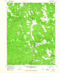
1957 Map of Conifer
USGS Topo · Published 1964About this map
Evergreen and Conifer anchor this mid-century look at the Jefferson County landscape, where residential mountain pockets like Marshdale and Aspen Park were developing alongside the vast Arapaho National Forest. The map documents a transition from a rural ranching and mining past to a more recreation-focused era, evidenced by the numerous Denver Mountain Park Sites and the establishment of James Q Newton Park. Local education is centered at Wilmot Sch and West Jefferson Sch, while community life is represented by the Wild Rose Grange and Pleasant Park Grange. Genealogists will find interest in Pleasant Park Cem and several family-named landmarks, including Oehlmann Park and Graves. The rugged hydrology is defined by the North Turkey Creek and South Turkey Creek systems, which carved the terrain long before modern suburban density reached these heights.
Find a feature on this map
51 named features on this map. Tap any name to fly to it.
Don’t see what you’re looking for? This feature index may not catch every label — zoom into the map to look around manually.
Map Details
Editions of this 1957 Conifer Map
2 editions found
Other maps of this area

1893 · Platte Canyon
USGS Topo · 1:125,000

1899 · West Denver
USGS Topo · 1:125,000

1938 · Morrison
USGS Topo · 1:24,000

1942 · Morrison
USGS Topo · 1:31,680

1945 · Indian Hills
USGS Topo · 1:31,680

1945 · Platte Canyon
USGS Topo · 1:24,000

1945 · Pine
USGS Topo · 1:24,000

1945 · Bailey
USGS Topo · 1:24,000
1947 · Morrison
USGS Topo · 1:31,680

1948 · Pine
USGS Topo · 1:24,000