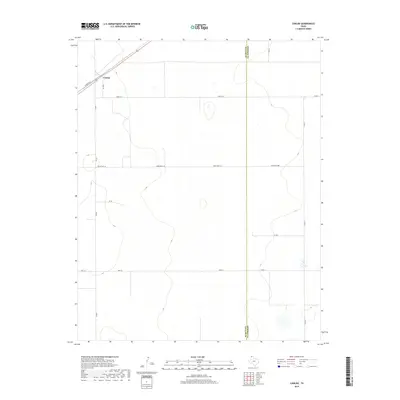
2019 Map of Conlen
USGS Topo · Published 2019About this map
The settlement of Conlen serves as the primary focal point in this 2019 survey of the High Plains, situated in the northwestern corner of the quadrangle. The map documents a landscape defined by its agricultural grid and the intersection of the Dallam Co and Sherman Co boundary line. This modern topographic record captures the rural infrastructure of the Texas Panhandle, showing a network of ranch roads and lanes that provide access to the expansive terrain. Key transit corridors include Crabtree Ln, Jake Rd, and Cedar Post Ln, which bisect the undulating contours of the region. The map also traces the path of Ranch Rd 2899 and Seed Ln, reflecting the enduring reliance on these local connectors to navigate the high-elevation plains between major regional thoroughfares.
Find a feature on this map
17 named features on this map. Tap any name to fly to it.
Don’t see what you’re looking for? This feature index may not catch every label — zoom into the map to look around manually.
Map Details
Editions of this 2019 Conlen Map
This is the sole edition of this map. No revisions or reprints were ever made.
Other maps of this area

1954 · Dalhart
USGS Topo · 1:250,000

1958 · Dalhart
USGS Topo · 1:250,000

1962 · Dalhart
USGS Topo · 1:250,000

1964 · Brickel
USGS Topo · 1:24,000

1964 · Stratford 2 SE
USGS Topo · 1:24,000

1964 · Stratford
USGS Topo · 1:24,000

1965 · Wilco
USGS Topo · 1:24,000

1965 · Lautz
USGS Topo · 1:24,000

1965 · Conlen
USGS Topo · 1:24,000
1965 · Cactus West
USGS Topo · 1:24,000