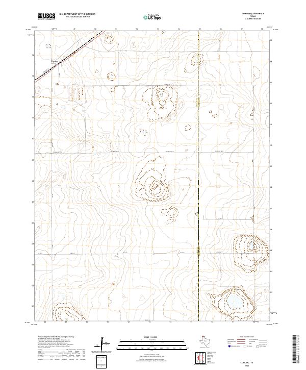
2022 Map of Conlen
USGS Topo · Published 2022About this map
The settlement of Conlen serves as the focal point for this survey of the high plains along the border of Dallam Co and Sherman Co. Located in the far northwest corner of the Texas Panhandle, the landscape is defined by a grid of rural roads and large-scale agricultural infrastructure typical of the region's ranching and farming economy. Primary transportation is facilitated by Highway 54 and FM 807, which connect the small community to the surrounding plains. The map reveals the intricate network of local access roads with names like Crabtree Ln, Jake Rd, and Seed Ln, reflecting the homesteading and ranching heritage of the area. Large industrial or agricultural enclosures are visible near the junction of Conlen Ln and Jake Rd, illustrating the modern evolution of land use in this corner of the state.
Find a feature on this map
17 named features on this map. Tap any name to fly to it.
Don’t see what you’re looking for? This feature index may not catch every label — zoom into the map to look around manually.
Map Details
Editions of this 2022 Conlen Map
This is the sole edition of this map. No revisions or reprints were ever made.
Other maps of this area

1954 · Dalhart
USGS Topo · 1:250,000

1958 · Dalhart
USGS Topo · 1:250,000

1962 · Dalhart
USGS Topo · 1:250,000

1964 · Brickel
USGS Topo · 1:24,000

1964 · Stratford 2 SE
USGS Topo · 1:24,000

1964 · Stratford
USGS Topo · 1:24,000

1965 · Wilco
USGS Topo · 1:24,000

1965 · Lautz
USGS Topo · 1:24,000

1965 · Conlen
USGS Topo · 1:24,000
1965 · Cactus West
USGS Topo · 1:24,000