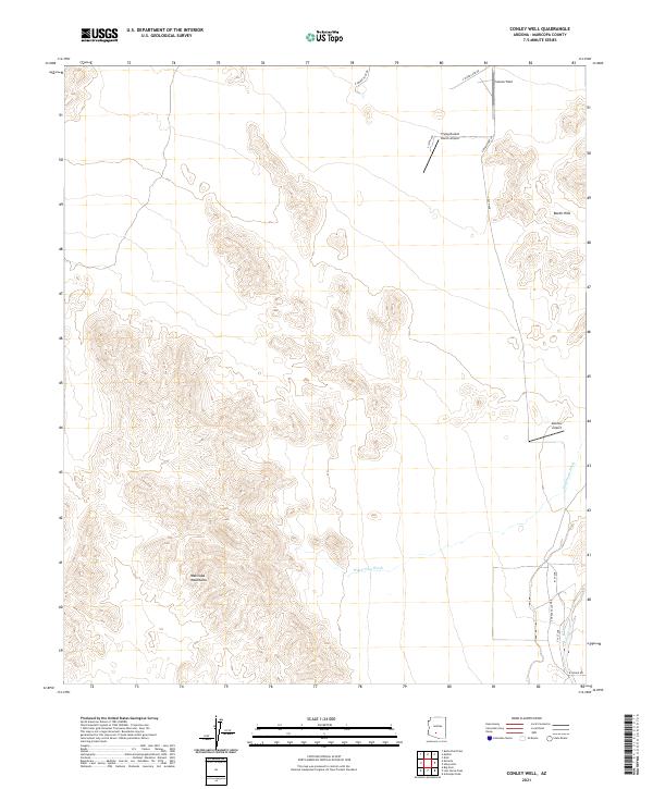
2021 Map of Conley Well
USGS Topo · Published 2021About this map
The Maricopa Mountains dominate the southwestern portion of this desert landscape, characterized by complex topographic contours and prominent drainage systems. Significant watercourses like Waterman Wash and Vekol Wash cut through the arid terrain, defining the natural movement of water across the basin. Small-scale aviation facilities are scattered throughout the northern and eastern sections, including Flying Bucket Ranch Airport, Serene Field, and Motown Airport, indicating the specialized use of this open space.
Find a feature on this map
19 named features on this map. Tap any name to fly to it.
Don’t see what you’re looking for? This feature index may not catch every label — zoom into the map to look around manually.
Map Details
Editions of this 2021 Conley Well Map
This is the sole edition of this map. No revisions or reprints were ever made.
Other maps of this area

1913 · Maricopa
USGS Topo · 1:62,500

1915 · Maricopa
USGS Topo · 1:62,500

1946 · Antelope Peak
USGS Topo · 1:62,500

1948 · Antelope Peak
USGS Topo · 1:62,500

1951 · Estrella
USGS Topo · 1:62,500

1951 · Mobile
USGS Topo · 1:62,500

1952 · Enid
USGS Topo · 1:24,000
1952 · Maricopa
USGS Topo · 1:62,500

1953 · Ajo
USGS Topo · 1:250,000

1954 · Phoenix
USGS Topo · 1:250,000