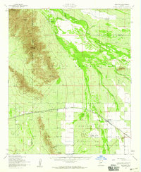
1952 Map of Maricopa
USGS Topo · Published 1959About this map
The Sierra Estrella mountains dominate the western landscape of this mid-century survey, creating a dramatic backdrop for the development of the lower Santa Cruz Valley. At the foot of these peaks, the Southern Pacific railroad corridor serves as the primary artery for local commerce, connecting the settlements of Maricopa, Heaton, and Enid. The map details the transition from high desert peaks like Montezumas Head and Butterfly Mtn to the agricultural and tribal lands of the Gila River Indian Reservation and Maricopa Indian Reservation. Local history is preserved in the location of the St Francis Mission near Ak Chin and the presence of ancient Ruins along the Gila River. The intricate network of irrigation ditches and washes, such as Vekol Wash, underscores the vital importance of water management in this arid region during the early 1950s.
Find a feature on this map
25 named features on this map. Tap any name to fly to it.
Don’t see what you’re looking for? This feature index may not catch every label — zoom into the map to look around manually.
Map Details
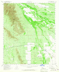
Editions of this 1952 Maricopa Map
2 editions found
Other maps of this area

1912 · Phoenix
USGS Topo · 1:62,500

1913 · Mesa
USGS Topo · 1:62,500

1913 · Maricopa
USGS Topo · 1:62,500

1914 · Gila Butte
USGS Topo · 1:62,500

1914 · Phoenix
USGS Topo · 1:62,500

1915 · Mesa
USGS Topo · 1:62,500

1915 · Maricopa
USGS Topo · 1:62,500

1917 · Gila Butte
USGS Topo · 1:62,500

1922 · Casa Grande
USGS Topo · 1:62,500

1924 · Casa Grande
USGS Topo · 1:62,500