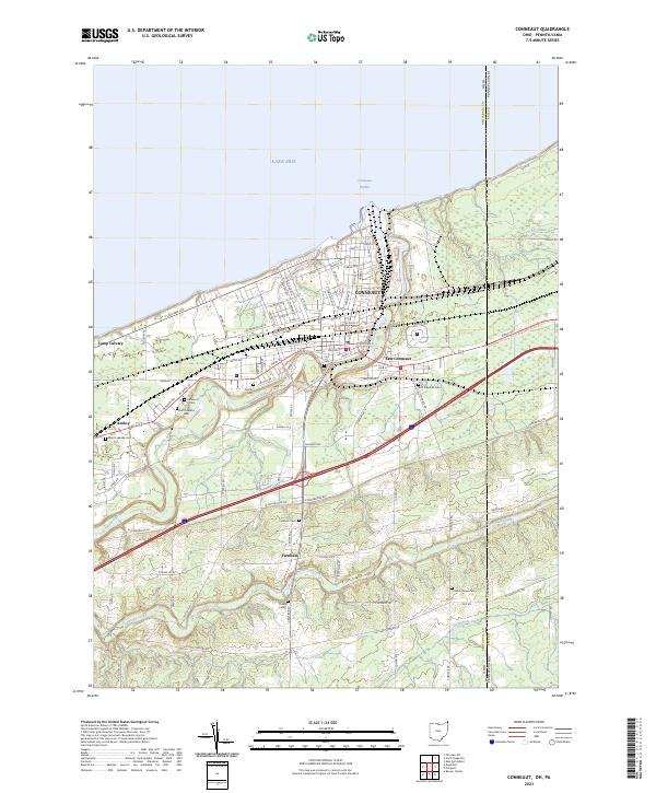
2023 Map of Conneaut
USGS Topo · Published 2023About this map
Conneaut and its surrounding coastal landscape sit at the northern edge of the Ohio-Pennsylvania border, where the deep waters of Lake Erie meet the winding mouth of Conneaut Creek. This modern survey reveals a highly developed shoreline centered on Conneaut Harbor, supporting a transportation network that bridges the state line via State Line Rd. The inland terrain is marked by a dense concentration of historical burial grounds, including Glenwood Cem, Saint Josephs Cem, and East Lakeville Cem, suggesting a long-standing community with multi-generational roots. Outside the main city center of East Conneaut, the landscape transitions into more rural clusters like Farnham and Amboy. The presence of the Ridge Rd Great Lakes Seaway Trail highlights the area's modern role as a transit corridor for travelers along the lake shore, while numerous family-named roads like Hatches Corners Rd and J F Kennedy Rd define the local geography.
Find a feature on this map
93 named features on this map. Tap any name to fly to it.
Don’t see what you’re looking for? This feature index may not catch every label — zoom into the map to look around manually.
Map Details
Editions of this 2023 Conneaut Map
This is the sole edition of this map. No revisions or reprints were ever made.
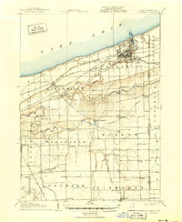
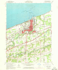
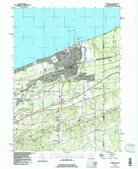
Historical Maps of Monroe Township Through Time
4 maps found