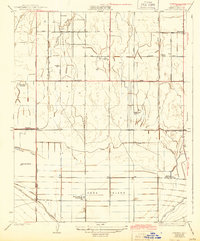
1933 Map of Conner
USGS Topo · Published 1944About this map
Kern Island and the surrounding agricultural landscape south of Bakersfield are defined by an intricate network of irrigation and drainage infrastructure. This survey captures a rural territory transitioning through the 1930s, where the management of water via the Stine Canal, Kern Island Canal, and Old Rim Ditch was essential to the survival of large-scale operations like Lakeside Ranch and McKittrick Ranch. The presence of the Shafter Migratory Sch provides a compelling look into the social history of the era, reflecting the educational needs of a mobile labor force during the Great Depression.
Find a feature on this map
35 named features on this map. Tap any name to fly to it.
Don’t see what you’re looking for? This feature index may not catch every label — zoom into the map to look around manually.
Map Details
Editions of this 1933 Conner Map
2 editions found
Other maps of this area

1910 · Buena Vista Lake
USGS Topo · 1:125,000

1912 · Buena Vista Lake
USGS Topo · 1:125,000

1914 · Caliente
USGS Topo · 1:125,000

1929 · Stevens
USGS Topo · 1:31,680

1929 · Fairfax School
USGS Topo · 1:31,680

1930 · Weed Patch
USGS Topo · 1:31,680

1930 · Millux
USGS Topo · 1:31,680

1930 · Conner
USGS Topo · 1:31,680

1931 · West of Tejon Hills
USGS Topo · 1:31,680

1931 · Hayes Ranch
USGS Topo · 1:31,680