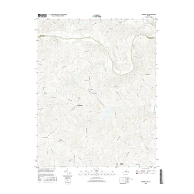
2016 Map of Conner Lake
USGS Topo · Published 2016About this map
The Roanoke River forms the natural boundary between Charlotte and Halifax Counties in this southern Virginia landscape. Historically significant rural communities like Providence and Crossroads anchor the region, connected by a network of local roads such as Mortons Ferry Rd and Coles Ferry Rd, which suggest a heritage of river crossings before modern bridges. Genealogists will find a wealth of records in the numerous burial grounds documented here, including Ellis Creek Cem, Providence Cem, Mount Pleasant Cem, and Hunting Creek Cem. The terrain is defined by the significant reservoir of Conner Lake and the various tributaries that feed the Roanoke watershed, such as Buckskin Cr and Hunting Cr. These small watercourses and family-named roads like Addie Williams Trl and Neals Corner Rd preserve the rural layout of the county's farming history.
Find a feature on this map
49 named features on this map. Tap any name to fly to it.
Don’t see what you’re looking for? This feature index may not catch every label — zoom into the map to look around manually.
Map Details
Editions of this 2016 Conner Lake Map
This is the sole edition of this map. No revisions or reprints were ever made.
Other maps of this area

1892 · Appomattox
USGS Topo · 1:125,000

1947 · Roanoke
USGS Topo · 1:250,000

1953 · Greensboro
USGS Topo · 1:250,000

1954 · Greensboro
USGS Topo · 1:250,000

1954 · Clover
USGS Topo · 1:62,500

1954 · Halifax
USGS Topo · 1:62,500

1956 · Brookneal
USGS Topo · 1:62,500

1956 · Charlotte Court House
USGS Topo · 1:62,500

1959 · Roanoke
USGS Topo · 1:250,000

1962 · Greensboro
USGS Topo · 1:250,000