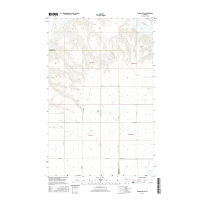
2017 Map of Conrad Butte
USGS Topo · Published 2017About this map
Conrad Butte rises as a prominent landmark above the sectioned agricultural lands on the border of Toole and Pondera counties. This modern survey illustrates a landscape defined by water management and a rigid grid of rural infrastructure, where routes like Ledger Rd and Reclamation Rd service the surrounding high plains. The winding course of the Marias River and its Dry Fork cut through the northern terrain, creating a sharp contrast with the flat expanses of Atkinson Flat and Tank Flat. Irrigation and local water storage are central to the region's character, as evidenced by the presence of the Jim Judisch Reservoir and the M Ratzburg Reservoir. Named local roads such as Union School Rd and Judisch Rd provide specific geographic markers for those tracing family ties or historical property lines in this portion of North Central Montana.
Find a feature on this map
24 named features on this map. Tap any name to fly to it.
Don’t see what you’re looking for? This feature index may not catch every label — zoom into the map to look around manually.
Map Details
Editions of this 2017 Conrad Butte Map
This is the sole edition of this map. No revisions or reprints were ever made.
Other maps of this area

1920 · Conrad
USGS Topo · 1:125,000

1954 · Shelby
USGS Topo · 1:250,000

1958 · Shelby
USGS Topo · 1:250,000

1967 · Central School
USGS Topo · 1:24,000

1967 · Naismith
USGS Topo · 1:24,000

1967 · Conrad Butte
USGS Topo · 1:24,000

1967 · South Devon School
USGS Topo · 1:24,000

1967 · Dunkirk
USGS Topo · 1:24,000

1967 · Fowler Coulee NW
USGS Topo · 1:24,000
1967 · Letz Lake
USGS Topo · 1:24,000