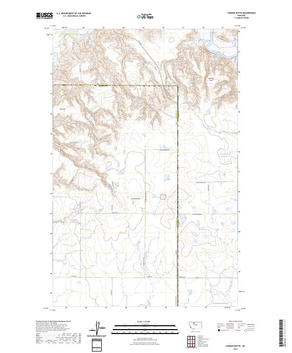
2024 Map of Conrad Butte
USGS Topo · Published 2024About this map
The Marias River carves through the northern landscape of this High Plains region, creating a stark contrast to the level expanses of Atkinson Flat and Tank Flat. The terrain is defined by the prominent Conrad Butte, a landform that serves as a central navigational marker for the surrounding agricultural grid. This modern survey illustrates a classic Western township structure, where the Toole Co Pondera Co line bisects the territory. Local water management is evident through the development of the Jim Judisch Reservoir and M Ratzburg Reservoir, which support the rural economy. Traces of historical movement remain in the branding of Whoop Up Trl, while the local social fabric is anchored by landmarks like Union School Rd, reflecting a landscape meticulously organized for large-scale ranching and farming.
Find a feature on this map
26 named features on this map. Tap any name to fly to it.
Don’t see what you’re looking for? This feature index may not catch every label — zoom into the map to look around manually.
Map Details
Editions of this 2024 Conrad Butte Map
This is the sole edition of this map. No revisions or reprints were ever made.
Other maps of this area

1920 · Conrad
USGS Topo · 1:125,000

1954 · Shelby
USGS Topo · 1:250,000

1958 · Shelby
USGS Topo · 1:250,000

1967 · Central School
USGS Topo · 1:24,000

1967 · Naismith
USGS Topo · 1:24,000

1967 · Conrad Butte
USGS Topo · 1:24,000

1967 · South Devon School
USGS Topo · 1:24,000

1967 · Dunkirk
USGS Topo · 1:24,000

1967 · Fowler Coulee NW
USGS Topo · 1:24,000
1967 · Letz Lake
USGS Topo · 1:24,000