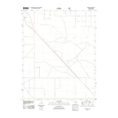
2011 Map of Conrad
USGS Topo · Published 2011About this map
Conrad anchors the northwestern corner of this High Plains landscape, situated along the edge of the Beaver River valley in the Oklahoma Panhandle. The river itself follows a winding, braided course across the northern reaches of the quadrangle, serving as the primary drainage for this arid region. The terrain is defined by a rigorous grid of section-line roads, such as N0370 Rd and E0273 Rd, which illustrate the systematic land survey patterns of Cimarron County. A notable exception to this geometric layout is the diagonal route of N0397 Rd, which cuts across the grid as it moves toward the state line. Near the northeastern corner, Ritner Lake provides a rare point of permanent surface water in an otherwise dry, agricultural environment. The geography here is typical of the borderlands between Oklahoma and Texas, where the vast, open expanses are punctuated only by small settlements and the persistent path of the river.
Find a feature on this map
25 named features on this map. Tap any name to fly to it.
Don’t see what you’re looking for? This feature index may not catch every label — zoom into the map to look around manually.
Map Details
Editions of this 2011 Conrad Map
This is the sole edition of this map. No revisions or reprints were ever made.
Other maps of this area

1954 · Dalhart
USGS Topo · 1:250,000

1958 · Dalhart
USGS Topo · 1:250,000

1962 · Dalhart
USGS Topo · 1:250,000

1964 · Kerrick
USGS Topo · 1:24,000

1964 · Stratford 2 NE
USGS Topo · 1:24,000

1971 · Griggs SW
USGS Topo · 1:24,000

1971 · Sampsel Lake
USGS Topo · 1:24,000

1971 · Conrad NW
USGS Topo · 1:24,000

1971 · Griggs NW
USGS Topo · 1:24,000

1971 · Conrad SW
USGS Topo · 1:24,000