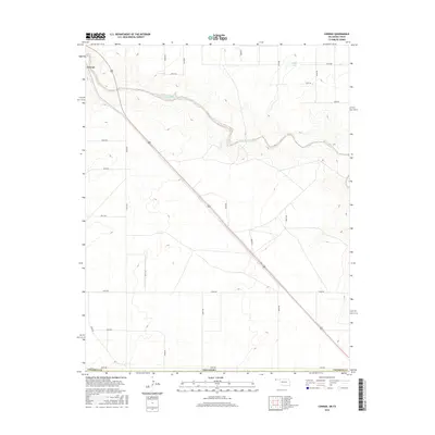
2016 Map of Conrad
USGS Topo · Published 2016About this map
Conrad anchors the high plains of the Oklahoma Panhandle in this 2016 survey, situated just north of where the Beaver River winds through the northern portion of Cimarron County. The landscape is defined by the stark geometry of Section Line roads and the diagonal path of U.S. Route 287, which cuts across the terrain from the northwest to the southeast. Outside of the primary settlement, the map traces the subtle hydrography of the region, including Ritner Lake and the various drainages that feed into the river valley. A sparse network of rural routes like Sandy Trl and E0350 Rd provides access to the surrounding ranching and agricultural lands, reflecting the enduring rural character and spatial organization of the western panhandle.
Find a feature on this map
28 named features on this map. Tap any name to fly to it.
Don’t see what you’re looking for? This feature index may not catch every label — zoom into the map to look around manually.
Map Details
Editions of this 2016 Conrad Map
This is the sole edition of this map. No revisions or reprints were ever made.
Other maps of this area

1954 · Dalhart
USGS Topo · 1:250,000

1958 · Dalhart
USGS Topo · 1:250,000

1962 · Dalhart
USGS Topo · 1:250,000

1964 · Kerrick
USGS Topo · 1:24,000

1964 · Stratford 2 NE
USGS Topo · 1:24,000

1971 · Griggs SW
USGS Topo · 1:24,000

1971 · Sampsel Lake
USGS Topo · 1:24,000

1971 · Conrad NW
USGS Topo · 1:24,000

1971 · Griggs NW
USGS Topo · 1:24,000

1971 · Conrad SW
USGS Topo · 1:24,000