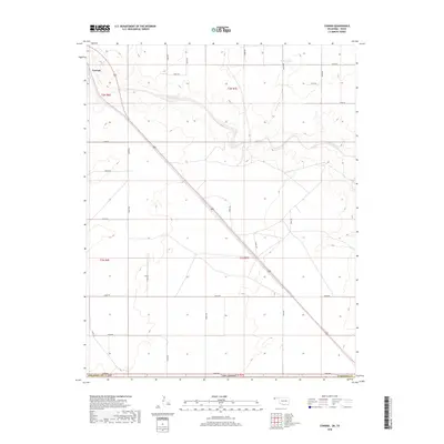
2018 Map of Conrad
USGS Topo · Published 2018About this map
Conrad and its surrounding High Plains landscape are defined by the meandering path of the Beaver River, which carves a wide, irregular valley through the Panhandle terrain. This 2018 survey documents a region characterized by large-scale sectioning and a sparse settlement pattern, where life and transit are organized around the diagonal transit of US Route 287. To the northeast, the isolated Ritner Lake provides one of the few named landmarks away from the river’s drainage. The map reveals the rigid grid of the Public Land Survey System, with township boundaries like t2n r7e and t1n r6e intersecting the highway. A network of rural section roads, including E0270 Rd and E0350 Rd, facilitates access across the open Cimarron County landscape, illustrating the enduring agricultural and ranching layout of Oklahoma's westernmost reaches.
Find a feature on this map
21 named features on this map. Tap any name to fly to it.
Don’t see what you’re looking for? This feature index may not catch every label — zoom into the map to look around manually.
Map Details
Editions of this 2018 Conrad Map
This is the sole edition of this map. No revisions or reprints were ever made.
Other maps of this area

1954 · Dalhart
USGS Topo · 1:250,000

1958 · Dalhart
USGS Topo · 1:250,000

1962 · Dalhart
USGS Topo · 1:250,000

1964 · Kerrick
USGS Topo · 1:24,000

1964 · Stratford 2 NE
USGS Topo · 1:24,000

1971 · Griggs SW
USGS Topo · 1:24,000

1971 · Sampsel Lake
USGS Topo · 1:24,000

1971 · Conrad NW
USGS Topo · 1:24,000

1971 · Griggs NW
USGS Topo · 1:24,000

1971 · Conrad SW
USGS Topo · 1:24,000