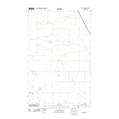
2011 Map of Conrad SW
USGS Topo · Published 2011About this map
Apocolipse Dam and the surrounding high plains of Pondera County define this landscape in the early 21st century. The map illustrates a strictly organized grid of rural roads, including Arod Lakes Rd and Shining Mt Rd, which facilitate access to the region's agricultural lands. The topography is marked by natural drainage features such as Maucki Coulee and Farmers Coulee, which cut through the terrain toward the southern edge of the survey area. Small water bodies like the Eyraud Lakes dot the prairie, highlighting the importance of water management in this northern Montana environment. This survey captures a moment when traditional ranching and farming infrastructure, represented by landmarks like Healy Spring Rd, continued to shape the local geography alongside modern highway developments like Hwy 91 South.
Find a feature on this map
12 named features on this map. Tap any name to fly to it.
Don’t see what you’re looking for? This feature index may not catch every label — zoom into the map to look around manually.
Map Details
Editions of this 2011 Conrad SW Map
This is the sole edition of this map. No revisions or reprints were ever made.
Other maps of this area

1886 · Great Falls
USGS Topo · 1:250,000

1920 · Choteau
USGS Topo · 1:125,000

1920 · Dupuyer
USGS Topo · 1:125,000

1920 · Conrad
USGS Topo · 1:125,000

1938 · Gallup City
USGS Topo · 1:62,500

1942 · Gallup City
USGS Topo · 1:62,500

1950 · Collins
USGS Topo · 1:62,500

1954 · Great Falls
USGS Topo · 1:250,000

1954 · Shelby
USGS Topo · 1:250,000

1955 · Choteau
USGS Topo · 1:250,000