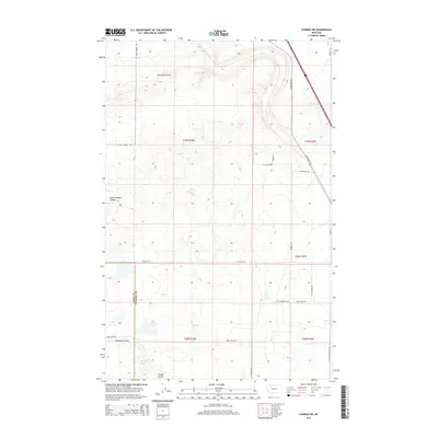
2014 Map of Conrad SW
USGS Topo · Published 2014About this map
Eyraud Lakes and the seasonally shifting waters of the plains define this section of the Montana landscape, located along the border of Teton Co Pondera Co. The terrain is characterized by its network of coulees, which serve as natural drainages across the agricultural grid. These include Railroad Coulee, South Pondera Coulee, and Brady Coulee, which carve subtle depressions through the township lines of t27n r3w and t26n r2w. Transportation throughout the area is anchored by US Highway 91 S, which runs alongside secondary routes such as Arod Lakes Rd and Healy Spring Rd. The map illustrates a highly organized rural infrastructure, where local roads like O'Brien Ln and Gopher Rd connect isolated ranching or farming properties within the vast open country of North Central Montana.
Find a feature on this map
23 named features on this map. Tap any name to fly to it.
Don’t see what you’re looking for? This feature index may not catch every label — zoom into the map to look around manually.
Map Details
Editions of this 2014 Conrad SW Map
This is the sole edition of this map. No revisions or reprints were ever made.
Other maps of this area

1886 · Great Falls
USGS Topo · 1:250,000

1920 · Choteau
USGS Topo · 1:125,000

1920 · Dupuyer
USGS Topo · 1:125,000

1920 · Conrad
USGS Topo · 1:125,000

1938 · Gallup City
USGS Topo · 1:62,500

1942 · Gallup City
USGS Topo · 1:62,500

1950 · Collins
USGS Topo · 1:62,500

1954 · Great Falls
USGS Topo · 1:250,000

1954 · Shelby
USGS Topo · 1:250,000

1955 · Choteau
USGS Topo · 1:250,000