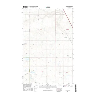
2017 Map of Conrad SW
USGS Topo · Published 2017About this map
Eyraud Lakes and a series of deep drainages define this stretch of the high plains along the Teton and Pondera County line. The landscape is marked by the distinct hydraulic patterns of the northern prairies, where Railroad Coulee, South Pondera Coulee, and Brady Coulee carve through the terrain. These natural watercourses dictated the placement of the rural road network, with routes like Arod Lakes Rd and W Valley Rd navigating the breaks. The presence of Farmers Coulee and Kropp Coulee in the southern sections further illustrates the complex drainage system feeding into the larger regional basins. This survey captures a rural Montana infrastructure built on land sectioning and resource access, evidenced by the proximity of Gravel Pit Rd and numerous access trails servicing the agricultural and ranching interior during the early 21st century.
Find a feature on this map
24 named features on this map. Tap any name to fly to it.
Don’t see what you’re looking for? This feature index may not catch every label — zoom into the map to look around manually.
Map Details
Editions of this 2017 Conrad SW Map
This is the sole edition of this map. No revisions or reprints were ever made.
Other maps of this area

1886 · Great Falls
USGS Topo · 1:250,000

1920 · Choteau
USGS Topo · 1:125,000

1920 · Dupuyer
USGS Topo · 1:125,000

1920 · Conrad
USGS Topo · 1:125,000

1938 · Gallup City
USGS Topo · 1:62,500

1942 · Gallup City
USGS Topo · 1:62,500

1950 · Collins
USGS Topo · 1:62,500

1954 · Great Falls
USGS Topo · 1:250,000

1954 · Shelby
USGS Topo · 1:250,000

1955 · Choteau
USGS Topo · 1:250,000