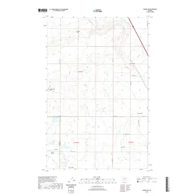
2020 Map of Conrad SW
USGS Topo · Published 2020About this map
Eyraud Lakes and a series of intermittent drainage channels define this portion of the Montana plains at the border of Teton and Pondera counties. The landscape is characterized by a network of coulees, including Railroad Coulee, South Pondera Coulee, and Brady Coulee, which dictate the local topography and drainage patterns. The human footprint is marked by a precise grid of rural roads, such as Arod Lakes Rd and Gopher Rd, facilitating movement between agricultural tracts and local landmarks like Farmers Coulee and Kropp Coulee. The presence of Midway Colony Ln reflects the area's social geography, specifically the Hutterite agricultural tradition that remains a cornerstone of the region. This 2020 survey provides a clear view of the section lines and transport routes, from the arterial Heien Dr to more specialized tracks like Gravel Pit Rd, essential for local infrastructure and resource management.
Find a feature on this map
25 named features on this map. Tap any name to fly to it.
Don’t see what you’re looking for? This feature index may not catch every label — zoom into the map to look around manually.
Map Details
Editions of this 2020 Conrad SW Map
This is the sole edition of this map. No revisions or reprints were ever made.
Other maps of this area

1886 · Great Falls
USGS Topo · 1:250,000

1920 · Choteau
USGS Topo · 1:125,000

1920 · Dupuyer
USGS Topo · 1:125,000

1920 · Conrad
USGS Topo · 1:125,000

1938 · Gallup City
USGS Topo · 1:62,500

1942 · Gallup City
USGS Topo · 1:62,500

1950 · Collins
USGS Topo · 1:62,500

1954 · Great Falls
USGS Topo · 1:250,000

1954 · Shelby
USGS Topo · 1:250,000

1955 · Choteau
USGS Topo · 1:250,000