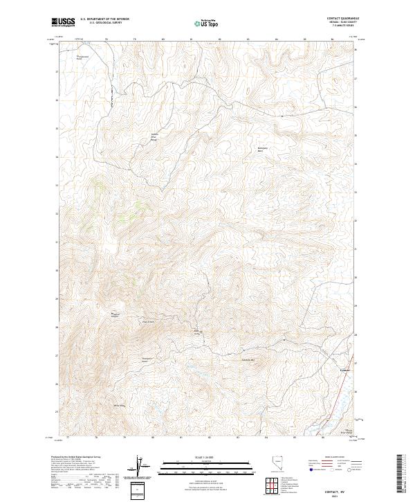
2021 Map of Contact
USGS Topo · Published 2021About this map
Contact is situated in the high desert of northeast Nevada, serving as a primary point of interest along the southern bend of Salmon Falls Cr. The settlement is defined by a grid including Main St and Elko Ave, positioned where the valley begins to rise toward the high ridges of the Salmon River Range. This 2021 survey illustrates a landscape deeply shaped by drainage and topography, from the northern expanse of Cottonwood Field to the peaks of Ellen D Mtn and Tabletop Mtn. The hydrology of the area is detailed through several seasonal and perennial sources, including Blue Jay Cr, Townsend Cr, and Bear Spring. Landmarks such as White Ridge, Mahogany Basin, and Bonanza Canyon provide specific points of reference for those studying the physical geography and ranching history of Elko County.
Find a feature on this map
21 named features on this map. Tap any name to fly to it.
Don’t see what you’re looking for? This feature index may not catch every label — zoom into the map to look around manually.
Map Details
Editions of this 2021 Contact Map
This is the sole edition of this map. No revisions or reprints were ever made.
Other maps of this area

1955 · Wells
USGS Topo · 1:250,000

1957 · Contact
USGS Topo · 1:62,500

1957 · Delaplain
USGS Topo · 1:62,500

1958 · Wells
USGS Topo · 1:250,000

1961 · Wells
USGS Topo · 1:250,000

1968 · Hubbard Basin
USGS Topo · 1:24,000

1968 · Henry
USGS Topo · 1:24,000

1968 · Blanchard Mtn
USGS Topo · 1:24,000

1982 · Jackpot
USGS Topo · 1:100,000
1989 · Jackpot
USGS Topo · 1:24,000