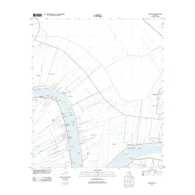
2012 Map of Convent
USGS Topo · Published 2012About this map
Convent and the surrounding riverfront communities in St. James Parish are defined by the winding course of the Mississippi River and the industrial infrastructure that supports its banks. This 2012 survey illustrates a landscape deeply shaped by the river's hydrology and economic utility, featuring significant protective works like the Romeville Revetment and Belmont Revetment. The proximity of the river to industrial energy interests is clear, with the Saint Amelia Gas Field and the Romeville Gas Field appearing alongside large-scale storage and transit points such as the Saint James Terminal Rd and the Department of Energy Rd. Evidence of the river's power is recorded in the Nita Crevasse and Belmont Crevasse, marking points where the levee was breached. Smaller settlements like Chatman Town, Free Town, and Hymel provide local context near the riverside, while historic burial grounds including Saint Michael Cem and Saint James Cem anchor the community history of the region.
Find a feature on this map
110 named features on this map. Tap any name to fly to it.
Don’t see what you’re looking for? This feature index may not catch every label — zoom into the map to look around manually.
Map Details
Editions of this 2012 Convent Map
This is the sole edition of this map. No revisions or reprints were ever made.
Other maps of this area

1892 · Lac Des Allemands
USGS Topo · 1:62,500

1892 · Mount Airy
USGS Topo · 1:62,500

1892 · Donaldsonville
USGS Topo · 1:62,500

1892 · Thibodaux
USGS Topo · 1:62,500

1927 · Thibodaux NW
USGS Topo · 1:31,680

1932 · Lac Des Allemands NW
USGS Topo · 1:31,680

1932 · Thibodaux NE
USGS Topo · 1:31,680

1935 · Gonzales
USGS Topo · 1:31,680

1939 · Donaldsonville
USGS Topo · 1:62,500

1940 · Lagan
USGS Topo · 1:31,680