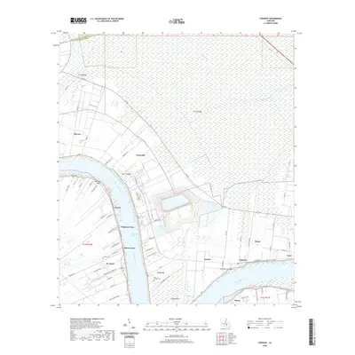
2020 Map of Convent
USGS Topo · Published 2020About this map
The Mississippi River carves a deep bend through St. James Parish, anchoring a landscape shaped by historical river breaches and sugar-country settlements. Along the river's winding path, legacy landmarks like Nita Crevasse and Belmont Crevasse indicate points where the levee once failed, permanently altering the local topography. The eastern and western banks are lined with historic communities including Convent, St. James, and Romeville, where the linear property patterns of old plantations are still visible in the road network. Genealogists can find significant local records at Saint Michael Cem, Saint James Cem, and Celestin Cem. To the north, the terrain transitions into the dense wetlands of the Blind River basin, while industrial infrastructure like the Capline Tank Rd and Department of Energy Rd signifies the modern energy corridor that now parallels these traditional riverfront settlements.
Find a feature on this map
76 named features on this map. Tap any name to fly to it.
Don’t see what you’re looking for? This feature index may not catch every label — zoom into the map to look around manually.
Map Details
Editions of this 2020 Convent Map
This is the sole edition of this map. No revisions or reprints were ever made.
Other maps of this area

1892 · Lac Des Allemands
USGS Topo · 1:62,500

1892 · Mount Airy
USGS Topo · 1:62,500

1892 · Donaldsonville
USGS Topo · 1:62,500

1892 · Thibodaux
USGS Topo · 1:62,500

1927 · Thibodaux NW
USGS Topo · 1:31,680

1932 · Lac Des Allemands NW
USGS Topo · 1:31,680

1932 · Thibodaux NE
USGS Topo · 1:31,680

1935 · Gonzales
USGS Topo · 1:31,680

1939 · Donaldsonville
USGS Topo · 1:62,500

1940 · Lagan
USGS Topo · 1:31,680