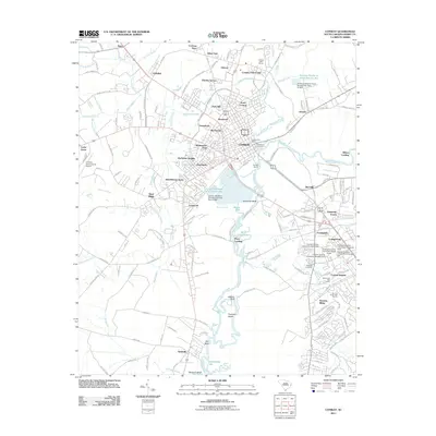
2011 Map of Conway
USGS Topo · Published 2011About this map
The Waccamaw River winds through the heart of this coastal plain landscape, defining the character of Conway and its surrounding communities. By the early 21st century, the area shows a distinct pattern of residential expansion, with numerous neighborhoods like Quattlebaum Acres, Huckabee Heights, and University Forest established around the historic center. The presence of Coastal Carolina University and its associated residence halls marks the southeastern corner of the quadrangle as a modern institutional hub, contrasting with the quiet riverine landings and swamps to the south and west.
Find a feature on this map
184 named features on this map. Tap any name to fly to it.
Don’t see what you’re looking for? This feature index may not catch every label — zoom into the map to look around manually.
Map Details
Editions of this 2011 Conway Map
This is the sole edition of this map. No revisions or reprints were ever made.
Other maps of this area

1937 · Myrtle Beach
USGS Topo · 1:48,000

1937 · Nixonville
USGS Topo · 1:48,000

1940 · Myrtle Beach
USGS Topo · 1:62,500

1942 · Nixonville
USGS Topo · 1:62,500

1943 · Yauhannah
USGS Topo · 1:24,000

1943 · Bucksville
USGS Topo · 1:24,000

1943 · Dongola
USGS Topo · 1:24,000

1943 · Adrian
USGS Topo · 1:24,000

1943 · Horry
USGS Topo · 1:24,000

1943 · Conway
USGS Topo · 1:24,000