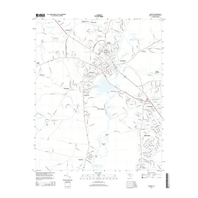
2014 Map of Conway
USGS Topo · Published 2014About this map
The Waccamaw River carves a winding path through this portion of Horry County, defining a landscape of low-lying wetlands and growing coastal plain settlements. Conway serves as the central hub, with its historic footprint bordered by Kingston Lake and the river's edge. The town's expansion is evident in the residential clusters of North Conway and Jamestown, while the campus of Coastal Carolina University marks a major educational anchor to the southeast in Red Hill.
Find a feature on this map
274 named features on this map. Tap any name to fly to it.
Don’t see what you’re looking for? This feature index may not catch every label — zoom into the map to look around manually.
Map Details
Editions of this 2014 Conway Map
This is the sole edition of this map. No revisions or reprints were ever made.
Other maps of this area

1937 · Myrtle Beach
USGS Topo · 1:48,000

1937 · Nixonville
USGS Topo · 1:48,000

1940 · Myrtle Beach
USGS Topo · 1:62,500

1942 · Nixonville
USGS Topo · 1:62,500

1943 · Yauhannah
USGS Topo · 1:24,000

1943 · Bucksville
USGS Topo · 1:24,000

1943 · Dongola
USGS Topo · 1:24,000

1943 · Adrian
USGS Topo · 1:24,000

1943 · Horry
USGS Topo · 1:24,000

1943 · Conway
USGS Topo · 1:24,000