2024 Map of Conway
USGS Topo · Published 2024About this map
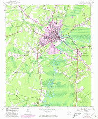
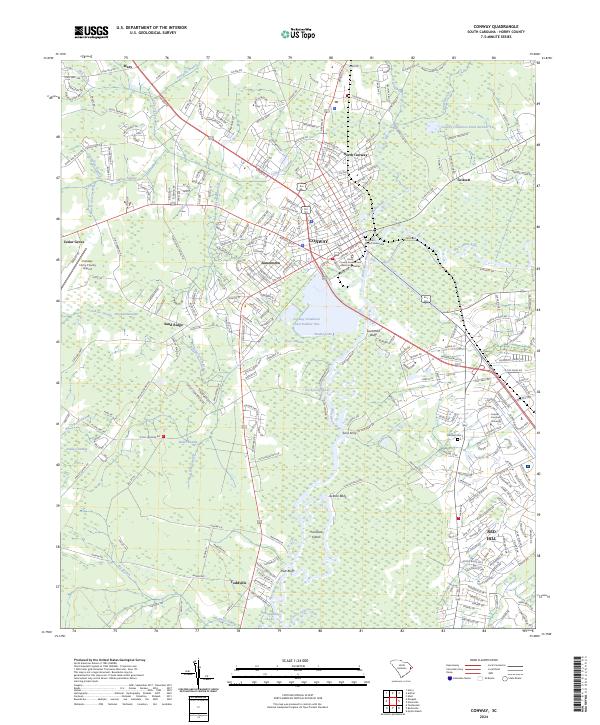
The Waccamaw River dictates the landscape of this Horry County region, where the city of Conway sits at the confluence of several major drainages including Crab Tree Swamp and Kingston Lake. The town serves as a significant hub, anchored by the Horry County Government and Justice Center and the Conway-Horry County Airport. To the south, the expansion of the Waccamaw National Wildlife Refuge preserves the river’s complex ecosystem of islands and bluffs, such as Thorofare Island and Pott Bluff. Historic river landings and crossings are still evident in the names of Savannah Bluff and Coxs Ferry, while the presence of Coastal Carolina University and the residential growth in Red Hill mark the modern educational and suburban reach of the area. Genealogists will find interest in the centrally located Kingston Church Graveyard and Hillcrest Cemetery.
Find a feature on this map
282 named features on this map. Tap any name to fly to it.
Don’t see what you’re looking for? This feature index may not catch every label — zoom into the map to look around manually.
Map Details
Editions of this 2024 Conway Map
This is the sole edition of this map. No revisions or reprints were ever made.