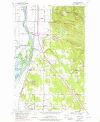
1956 Map of Conway
USGS Topo · Published 1976About this map
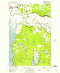
The South Fork Skagit River winds through a complex network of wetlands and agricultural lands, defining the character of this 1950s Skagit County landscape. The delta is a labyrinth of waterways, including Steamboat Slough, Freshwater Slough, and Tom Moore Slough, which isolate large tracts of land like Fir Island. These fertile areas are connected by a system of levees and roads such as Fir Island Rd, supporting a rural economy tied to the river and the Burlington Northern railroad.
Find a feature on this map
55 named features on this map. Tap any name to fly to it.
Don’t see what you’re looking for? This feature index may not catch every label — zoom into the map to look around manually.
Map Details
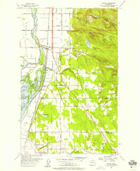
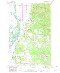
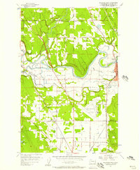
Editions of this 1956 Conway Map
4 editions found

Other maps of this area

1911 · Mount Vernon
USGS Topo · 1:125,000

1940 · Mt Vernon
USGS Topo · 1:62,500

1941 · Marysville
USGS Topo · 1:62,500

1943 · Marysville
USGS Topo · 1:62,500

1943 · Mt Vernon
USGS Topo · 1:62,500

1943 · Stanwood
USGS Topo · 1:62,500

1944 · Clear Lake
USGS Topo · 1:62,500
1956 · Arlington West
USGS Topo · 1:24,000
1956 · Stanwood
USGS Topo · 1:24,000
1956 · Utsalady
USGS Topo · 1:24,000