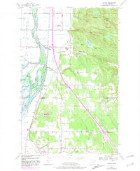
1956 Map of Conway
USGS Topo · Published 1981About this map
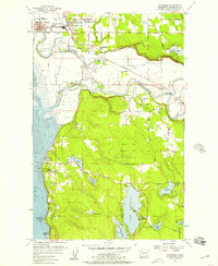
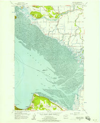
Fir Island and the complex delta of the South Fork Skagit River define this coastal landscape at the Skagit and Snohomish county line. The map captures a detailed network of waterways including Steamboat Slough, Freshwater Slough, and Tom Moore Slough, illustrating the reclaimed agricultural character of the delta protected by levees. The Burlington Northern railroad corridor serves as the primary north-south spine, connecting the settlements of Conway, Fir Station, and Milltown. East of the flats, the terrain rises sharply toward Scott Mtn and Devils Mtn, where small upland lakes like Sixteen Lake and Ten Lake are situated. This mid-century survey, with revisions into the late 1970s, preserves the locations of rural infrastructure such as the Conway Sch, Freeborn Church, and the Landing Strip near the northern boundary.
Find a feature on this map
61 named features on this map. Tap any name to fly to it.
Don’t see what you’re looking for? This feature index may not catch every label — zoom into the map to look around manually.
Map Details
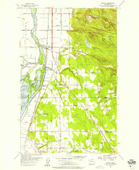
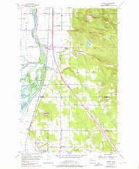
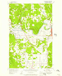
Editions of this 1956 Conway Map
4 editions found

Other maps of this area

1911 · Mount Vernon
USGS Topo · 1:125,000

1940 · Mt Vernon
USGS Topo · 1:62,500

1941 · Marysville
USGS Topo · 1:62,500

1943 · Marysville
USGS Topo · 1:62,500

1943 · Mt Vernon
USGS Topo · 1:62,500

1943 · Stanwood
USGS Topo · 1:62,500

1944 · Clear Lake
USGS Topo · 1:62,500
1956 · Arlington West
USGS Topo · 1:24,000
1956 · Stanwood
USGS Topo · 1:24,000
1956 · Utsalady
USGS Topo · 1:24,000