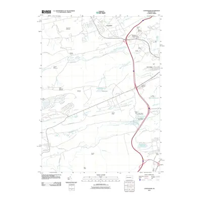
2010 Map of Conyngham
USGS Topo · Published 2010About this map
Sugarloaf Mountain and Butler Mountain dominate the topography of this Luzerne County landscape, where valley settlements are linked by a complex network of roads and water management systems. The industrial heritage of the region is evident at the Tomhicken Shaft Number Four and the Harwood Mines Post Office, pointing to a history of resource extraction that shaped local development. Education and public utility infrastructure are central to the modern character of the area, anchored by the Pennsylvania State University - Hazleton Campus and the Hazleton Water Works. A significant network of reservoirs, including the Humboldt Reservoir and Mount Pleasant Reservoir, underscores the importance of water control in this upland terrain. The map details residential clusters from Conyngham to the planned streets of Green Ridge, while the Humboldt Fire Tower stands as a sentinel over the surrounding ridges and the waters of Black Creek.
Find a feature on this map
68 named features on this map. Tap any name to fly to it.
Don’t see what you’re looking for? This feature index may not catch every label — zoom into the map to look around manually.
Map Details
Editions of this 2010 Conyngham Map
This is the sole edition of this map. No revisions or reprints were ever made.
Other maps of this area

1889 · Hazleton
USGS Topo · 1:62,500

1891 · Wilkesbarre
USGS Topo · 1:62,500

1891 · Hazleton
USGS Topo · 1:62,500

1892 · Mahanoy
USGS Topo · 1:62,500

1893 · Hazleton
USGS Topo · 1:62,500

1893 · Mahanoy
USGS Topo · 1:62,500

1894 · Shickshinny
USGS Topo · 1:62,500

1894 · Wilkesbarre
USGS Topo · 1:62,500

1943 · Scranton
USGS Topo · 1:125,000

1944 · Newark
USGS Topo · 1:250,000
Featured Places
- Conyngham, PA
- Sheppton, East Union Township
- Haddock, Kline Township
- Kelayres, Kline Township
- Green Ridge, Hazle Township