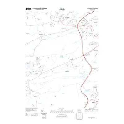
2013 Map of Conyngham
USGS Topo · Published 2013About this map
Conyngham sits at the northern edge of a landscape defined by industrial corridors and the prominent ridges of the Ridge-and-Valley Appalachians. This 2013 survey illustrates a modern infrastructure network of highways and rail junctions that support the region's historic ties to mining and manufacturing. Notable nodes like Oakbur Junction and Silver Brook Junction highlight the area's logistical importance, while the Humboldt Fire Tower stands as a landmark overlooking the expansive Humboldt Reservoir. To the south, the terrain becomes more pronounced with features like Pismire Ridge and Round Head rising above the winding Catawissa Creek. This map captures the spatial relationship between residential areas such as Dippel Manor and the specialized infrastructure of the Hazelton Muncipal Airport Runway, reflecting the complex land use patterns of Luzerne County.
Find a feature on this map
154 named features on this map. Tap any name to fly to it.
Don’t see what you’re looking for? This feature index may not catch every label — zoom into the map to look around manually.
Map Details
Editions of this 2013 Conyngham Map
This is the sole edition of this map. No revisions or reprints were ever made.
Other maps of this area

1889 · Hazleton
USGS Topo · 1:62,500

1891 · Wilkesbarre
USGS Topo · 1:62,500

1891 · Hazleton
USGS Topo · 1:62,500

1892 · Mahanoy
USGS Topo · 1:62,500

1893 · Hazleton
USGS Topo · 1:62,500

1893 · Mahanoy
USGS Topo · 1:62,500

1894 · Shickshinny
USGS Topo · 1:62,500

1894 · Wilkesbarre
USGS Topo · 1:62,500

1943 · Scranton
USGS Topo · 1:125,000

1944 · Newark
USGS Topo · 1:250,000
Featured Places
- Conyngham, PA
- Sheppton, East Union Township
- Haddock, Kline Township
- Kelayres, Kline Township
- Green Ridge, Hazle Township