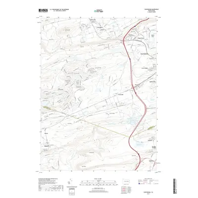
2019 Map of Conyngham
USGS Topo · Published 2019About this map
Conyngham and the neighboring village of Sybertsville sit at the northern edge of this Pennsylvania survey, where the valley terrain meets the slopes of Sugarloaf Mtn. The landscape is defined by its industrial and institutional footprints, including the Penn State Hazleton campus and the proximity of the Hazleton Regional Airport. As the map moves south across the Luzerne and Schuylkill county line, the geography shifts toward more specialized water management and mining-era infrastructure. Distinctive landmarks such as Horse Shoe Swamp and Pismire Ridge punctuate the ridges, while the presence of several reservoirs, including Mount Pleasant Reservoir and Number Eight Reservoir, highlights the regional water network. Settlements like Humboldt, Oneida, and Sheppton provide localized context for researchers tracing family history or the development of these coal-region communities.
Find a feature on this map
190 named features on this map. Tap any name to fly to it.
Don’t see what you’re looking for? This feature index may not catch every label — zoom into the map to look around manually.
Map Details
Editions of this 2019 Conyngham Map
This is the sole edition of this map. No revisions or reprints were ever made.
Other maps of this area

1889 · Hazleton
USGS Topo · 1:62,500

1891 · Wilkesbarre
USGS Topo · 1:62,500

1891 · Hazleton
USGS Topo · 1:62,500

1892 · Mahanoy
USGS Topo · 1:62,500

1893 · Hazleton
USGS Topo · 1:62,500

1893 · Mahanoy
USGS Topo · 1:62,500

1894 · Shickshinny
USGS Topo · 1:62,500

1894 · Wilkesbarre
USGS Topo · 1:62,500

1943 · Scranton
USGS Topo · 1:125,000

1944 · Newark
USGS Topo · 1:250,000
Featured Places
- Conyngham, PA
- Sheppton, East Union Township
- Haddock, Kline Township
- Kelayres, Kline Township
- Green Ridge, Hazle Township