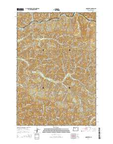
2014 Map of Cook Creek
USGS Topo · Published 2014About this map
The Nehalem River winds through the northern reaches of this Tillamook County landscape, joined by the Salmonberry River near the rugged elevation of Buick Canyon. This 2014 survey documents a timber-rich region defined by its complex drainage systems, where the headwaters of the Miami River and the N Fork Wilson River originate in the southern highlands. Named peaks like Buck Mtn and High Butte anchor the topography between deep-cut drainages such as Platt Canyon. Access to these remote interior forests is facilitated by a network of logging and forest service routes including Foss Rd, Cook Creek Rd, and Diamond Mill Rd. The map illustrates the intense vertical relief of the Oregon Coast Range, tracing numerous named tributaries such as Hatchery Cr and French Cr as they feed the primary river systems.
Find a feature on this map
39 named features on this map. Tap any name to fly to it.
Don’t see what you’re looking for? This feature index may not catch every label — zoom into the map to look around manually.
Map Details
Editions of this 2014 Cook Creek Map
This is the sole edition of this map. No revisions or reprints were ever made.
Other maps of this area

1937 · Nehalem
USGS Topo · 1:62,500

1937 · Enright
USGS Topo · 1:62,500

1939 · Saddle Mountain
USGS Topo · 1:62,500

1940 · Cape Falcon
USGS Topo · 1:62,500

1941 · Enright
USGS Topo · 1:62,500

1943 · Nehalem
USGS Topo · 1:62,500

1943 · Saddle Mtn.
USGS Topo · 1:62,500

1948 · Vancouver
USGS Topo · 1:250,000

1950 · Vancouver
USGS Topo · 1:250,000

1950 · Vancouver
USGS Topo · 1:250,000