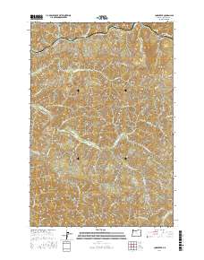
2017 Map of Cook Creek
USGS Topo · Published 2017About this map
Buck Mtn and High Butte dominate the high ground of this Tillamook County coastal range, where a complex network of waterways carves through the timbered landscape. The northern edge is defined by the Nehalem River and the Salmonberry River, which meet near Bulck Canyon. Moving south, the terrain feeds several distinct river systems, including the headwaters of the Miami River and the W Fork Wilson River.
Find a feature on this map
37 named features on this map. Tap any name to fly to it.
Don’t see what you’re looking for? This feature index may not catch every label — zoom into the map to look around manually.
Map Details
Editions of this 2017 Cook Creek Map
This is the sole edition of this map. No revisions or reprints were ever made.
Other maps of this area

1937 · Nehalem
USGS Topo · 1:62,500

1937 · Enright
USGS Topo · 1:62,500

1939 · Saddle Mountain
USGS Topo · 1:62,500

1940 · Cape Falcon
USGS Topo · 1:62,500

1941 · Enright
USGS Topo · 1:62,500

1943 · Nehalem
USGS Topo · 1:62,500

1943 · Saddle Mtn.
USGS Topo · 1:62,500

1948 · Vancouver
USGS Topo · 1:250,000

1950 · Vancouver
USGS Topo · 1:250,000

1950 · Vancouver
USGS Topo · 1:250,000